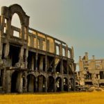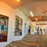
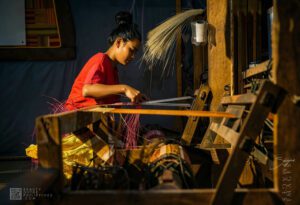
Binuatan Creations: The Living Craftsmanship of Palaweño Weaving
Among the cultural stops commonly included in inland tours around Puerto Princesa City, few places combine craftsmanship, livelihood, heritage, and tourism as naturally as Binuatan


 0 Mariano Sayno")
 0 Mariano Sayno")
 0 Mariano Sayno")
 0 Mariano Sayno")
 0 Mariano Sayno")
 0 Mariano Sayno")
 0 Mariano Sayno")
Among the cultural stops commonly included in inland tours around Puerto Princesa City, few places combine craftsmanship, livelihood, heritage, and tourism as naturally as Binuatan
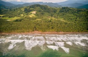
On the western shores of Aborlan, Palawan, Apurawan Beach quietly stretches along the West Philippine Sea, offering travelers a retreat from the island’s busier tourist

Tucked away in the lush greenery of Quezon, Palawan, Tumarbong Falls is a stunning waterfall destination that combines natural beauty, adventure, and cultural heritage. This
Among the cultural stops commonly included in inland tours around Puerto Princesa City, few places combine craftsmanship, livelihood, heritage, and tourism as naturally as Binuatan
Tucked away in the lush greenery of Quezon, Palawan, Tumarbong Falls is a stunning waterfall destination that combines natural beauty, adventure, and cultural heritage. This
On the western shores of Aborlan, Palawan, Apurawan Beach quietly stretches along the West Philippine Sea, offering travelers a retreat from the island’s busier tourist